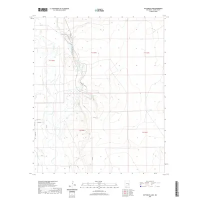
2020 Map of Bottomless Lakes
USGS Topo · Published 2020About this map
The Pecos River valley dominates this Chaves County landscape, where the river's winding path is flanked by a series of distinct sinkhole lakes east of its banks. These water bodies, including Lea Lake, Cottonwood Lake, and Mirror Lake, are concentrated along Bottomless Lakes Rd, reflecting the unique geological formations of this section of New Mexico. The contrast between the natural hydrology of Comanche Draw and the engineered utility of the Hagerman Canal in the southwest highlights the varied water management in the region. Local transportation is represented by a network of rural routes such as Co Rd 409 and 1G-Cattleco Rd, which serve the open terrain. In the northwest, residential development near the river is visible along Nancy Ann Ln and Michelet Dr, showing the intersection of local habitation and the riverine environment.
Find a feature on this map
29 named features on this map. Tap any name to fly to it.
Don’t see what you’re looking for? This feature index may not catch every label — zoom into the map to look around manually.
Map Details
Editions of this 2020 Bottomless Lakes Map
This is the sole edition of this map. No revisions or reprints were ever made.
Other maps of this area

1949 · Wade Ranch
USGS Topo · 1:24,000

1949 · L-E Ranch
USGS Topo · 1:24,000

1950 · Dexter West
USGS Topo · 1:24,000

1950 · Comanche Spring
USGS Topo · 1:24,000

1950 · Bottomless Lakes
USGS Topo · 1:24,000

1950 · South Spring
USGS Topo · 1:24,000

1950 · Bitter Lake
USGS Topo · 1:24,000

1950 · Dexter East
USGS Topo · 1:24,000

1952 · Bar C Bar Ranch
USGS Topo · 1:24,000

1955 · Roswell
USGS Topo · 1:250,000