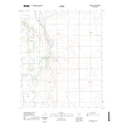
2023 Map of Bottomless Lakes
USGS Topo · Published 2023About this map
The Pecos River carves a winding path through this Chaves County landscape, defined by a chain of unique sinkhole lakes east of the riverbank. This geological corridor includes several prominent water bodies such as Lea Lake, Cottonwood Lake, and Figure Eight Lake, which form a cluster of deep natural basins along Bottomless Lakes Rd. The terrain transition is marked by the steep bluffs of Comanche Draw to the north and the expansive agricultural irrigation works of the Hagerman Canal to the west. Roads like Tg-Cattleco Rd and Park Svc Rd provide access through the arid ranching country, while the intricate contours around Dimmitt Lake reveal the collapsed topography that gives this region its distinctive character. This map documents the persistent water features and rural infrastructure in a landscape where desert ranching meets unique aquatic ecosystems.
Find a feature on this map
28 named features on this map. Tap any name to fly to it.
Don’t see what you’re looking for? This feature index may not catch every label — zoom into the map to look around manually.
Map Details
Editions of this 2023 Bottomless Lakes Map
This is the sole edition of this map. No revisions or reprints were ever made.
Other maps of this area

1949 · Wade Ranch
USGS Topo · 1:24,000

1949 · L-E Ranch
USGS Topo · 1:24,000

1950 · Dexter West
USGS Topo · 1:24,000

1950 · Comanche Spring
USGS Topo · 1:24,000

1950 · Bottomless Lakes
USGS Topo · 1:24,000

1950 · South Spring
USGS Topo · 1:24,000

1950 · Bitter Lake
USGS Topo · 1:24,000

1950 · Dexter East
USGS Topo · 1:24,000

1952 · Bar C Bar Ranch
USGS Topo · 1:24,000

1955 · Roswell
USGS Topo · 1:250,000