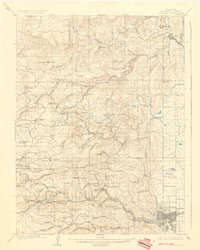
1904 Map of Boulder
USGS Topo · Published 1936About this map
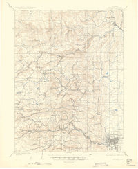
Gold-mining districts dominate the drainages of the South St. Vrain Creek and James Creek, where numerous small settlements like Jamestown, Sunshine, and Gold Hill are nestled among the steep gulches. This survey, based on 1902 fieldwork by Frank Tweedy, captures the intense mineral development of the Front Range during the early twentieth century. The industrial infrastructure is particularly evident along the Colorado and Northwestern RR, which snakes through the canyons to serve mining camps like Wallstreet and Sunset.
Find a feature on this map
110 named features on this map. Tap any name to fly to it.
Don’t see what you’re looking for? This feature index may not catch every label — zoom into the map to look around manually.
Map Details
Editions of this 1904 Boulder Map
6 editions found
Other maps of this area

1899 · West Denver
USGS Topo · 1:125,000

1902 · Boulder
USGS Topo · 1:62,500

1904 · Niwot
USGS Topo · 1:62,500

1904 · Boulder
USGS Topo · 1:62,500

1905 · Central City
USGS Topo · 1:62,500

1905 · Mount Olympus
USGS Topo · 1:62,500

1906 · Blackhawk
USGS Topo · 1:62,500

1906 · Loveland
USGS Topo · 1:62,500

1907 · Mount Olympus
USGS Topo · 1:62,500

1908 · Loveland
USGS Topo · 1:62,500