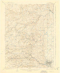
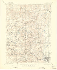
1904 Map of Boulder
USGS Topo · Published 1941About this map
The city of Boulder and its neighboring mining districts define this map of the Colorado Front Range at the turn of the century. The terrain is marked by a network of steep canyons and high peaks like Bighorn Mt. and Sugarloaf Mt., which dictated the path of early industrial transport. The Colorado and Northwestern RR winds through the southern portion of the sheet, providing vital access to mining camps and settlements including Salina, Crisman, and Wallstreet along the banks of Fourmile Creek.
Find a feature on this map
85 named features on this map. Tap any name to fly to it.
Don’t see what you’re looking for? This feature index may not catch every label — zoom into the map to look around manually.
Map Details
Editions of this 1904 Boulder Map
6 editions found
Other maps of this area

1899 · West Denver
USGS Topo · 1:125,000

1902 · Boulder
USGS Topo · 1:62,500

1904 · Niwot
USGS Topo · 1:62,500

1904 · Boulder
USGS Topo · 1:62,500

1905 · Central City
USGS Topo · 1:62,500

1905 · Mount Olympus
USGS Topo · 1:62,500

1906 · Blackhawk
USGS Topo · 1:62,500

1906 · Loveland
USGS Topo · 1:62,500

1907 · Mount Olympus
USGS Topo · 1:62,500

1908 · Loveland
USGS Topo · 1:62,500