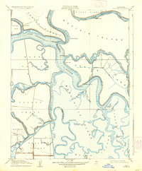
1910 Map of Bouldin
USGS Topo · Published 1937About this map
The intricate Delta landscape of the early 20th century is defined by a labyrinth of waterways surrounding massive islands and tracts. The San Joaquin River and Mokelumne River dominate the northern portion of the sheet, providing the primary arteries for commerce before the era of modern bridges and highways. Small riverside settlements and industrial outposts like Central Landing and the Old Cannery on Staten Island highlight the agricultural and canning economy that once thrived in these peat-rich lowlands. The complex network of sloughs, including Potato Slough and Criminal Slough, illustrates a time when the region relied heavily on water-based transport. Points of interest for researchers include family-named landmarks such as Hardscratch Pt and isolated water bodies like Turner Lake and Nibs Lake, which reflect the localized geography of the Mandeville Island and Venice Island areas before significant reclamation and modern alterations changed the face of the San Joaquin Delta.
Find a feature on this map
52 named features on this map. Tap any name to fly to it.
Don’t see what you’re looking for? This feature index may not catch every label — zoom into the map to look around manually.
Map Details
Editions of this 1910 Bouldin Map
3 editions found
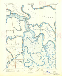
Other maps of this area

1894 · Lodi
USGS Topo · 1:125,000

1910 · New Hope
USGS Topo · 1:31,680

1910 · Rio Vista
USGS Topo · 1:31,680

1910 · Bouldin
USGS Topo · 1:31,680

1910 · Jersey
USGS Topo · 1:31,680

1910 · Headreach
USGS Topo · 1:31,680

1910 · Isleton
USGS Topo · 1:31,680

1913 · Woodward Island
USGS Topo · 1:31,680

1913 · Holt
USGS Topo · 1:31,680

1914 · Brentwood
USGS Topo · 1:31,680