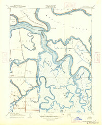
1910 Map of Bouldin
USGS Topo · Published 1947About this map
Bouldin Island and the intricate Sacramento-San Joaquin River Delta define this 1908 survey, capturing a landscape of levees and reclaimed marshland tracts. Navigable water serves as the primary artery for commerce and transport, evidenced by waterfront sites like Central Landing and Blakes Landing. The presence of an Old Cannery along the South Fork Mokelumne River points to the region's early industrial reliance on river-based exports.
Find a feature on this map
53 named features on this map. Tap any name to fly to it.
Don’t see what you’re looking for? This feature index may not catch every label — zoom into the map to look around manually.
Map Details
Editions of this 1910 Bouldin Map
3 editions found
Other maps of this area

1894 · Lodi
USGS Topo · 1:125,000

1910 · New Hope
USGS Topo · 1:31,680

1910 · Rio Vista
USGS Topo · 1:31,680

1910 · Bouldin
USGS Topo · 1:31,680

1910 · Jersey
USGS Topo · 1:31,680

1910 · Headreach
USGS Topo · 1:31,680

1910 · Isleton
USGS Topo · 1:31,680

1913 · Woodward Island
USGS Topo · 1:31,680

1913 · Holt
USGS Topo · 1:31,680

1914 · Brentwood
USGS Topo · 1:31,680