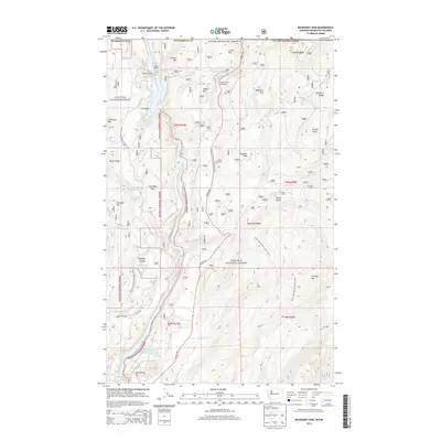
2014 Map of Boundary Dam
USGS Topo · Published 2014About this map
Boundary Dam stands as the central industrial anchor on the Pend-Oreille River just south of the international border. This survey of the Colville National Forest illustrates the intersection of energy production, resource extraction, and recreation in the early 21st century. The landscape is marked by the presence of the Grandview Pit and the Pend Oreille Mine Tailings Pond, reflecting the area's deep ties to the mining industry.
Find a feature on this map
54 named features on this map. Tap any name to fly to it.
Don’t see what you’re looking for? This feature index may not catch every label — zoom into the map to look around manually.
Map Details
Editions of this 2014 Boundary Dam Map
This is the sole edition of this map. No revisions or reprints were ever made.
Other maps of this area

1934 · Metaline
USGS Topo · 1:125,000

1942 · Metaline
USGS Topo · 1:125,000

1958 · Sandpoint
USGS Topo · 1:250,000

1963 · Sandpoint
USGS Topo · 1:250,000

1967 · Gypsy Peak
USGS Topo · 1:24,000

1967 · Boundary Dam
USGS Topo · 1:24,000

1967 · Metaline
USGS Topo · 1:24,000

1967 · Metaline Falls
USGS Topo · 1:24,000

1967 · Pass Creek
USGS Topo · 1:24,000
1967 · Abercrombie Mtn
USGS Topo · 1:24,000