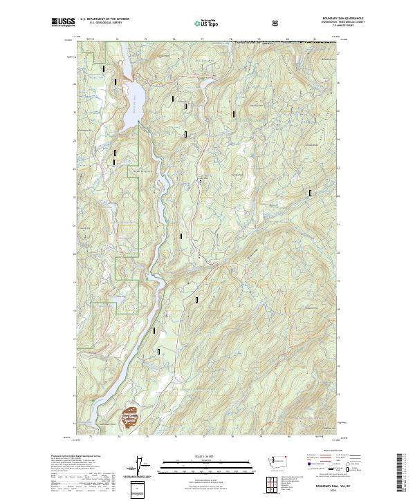
2023 Map of Boundary Dam
USGS Topo · Published 2023About this map
Harvey Grave sits on a high ridge in this remote corner of northeastern Washington, where the United States border meets the high peaks of the Colville National Forest. The landscape is dominated by the steep valley of the Pend Oreille River, which flows past dramatic features like Pewee Falls and the churning waters of Deadmans Eddy. The terrain is characterized by mineral-rich naming conventions, such as Dolomite Mtn, Limestone Hill, and the Lead King Hills, reflecting the area's geological and industrial history. Modern industrial footprints are visible near the southern edge at the Pend Oreille Mine Tailings Pond Dam near Grandview Point. Higher elevations transition into the protected Salmo-Priest Wilderness, where high-country lakes like Crater Lake and trails such as the Pacific Northwest National Scenic Trl traverse the Boundary Ridge.
Find a feature on this map
54 named features on this map. Tap any name to fly to it.
Don’t see what you’re looking for? This feature index may not catch every label — zoom into the map to look around manually.
Map Details
Editions of this 2023 Boundary Dam Map
This is the sole edition of this map. No revisions or reprints were ever made.
Other maps of this area

1934 · Metaline
USGS Topo · 1:125,000

1942 · Metaline
USGS Topo · 1:125,000

1958 · Sandpoint
USGS Topo · 1:250,000

1963 · Sandpoint
USGS Topo · 1:250,000

1967 · Gypsy Peak
USGS Topo · 1:24,000

1967 · Boundary Dam
USGS Topo · 1:24,000

1967 · Metaline
USGS Topo · 1:24,000

1967 · Metaline Falls
USGS Topo · 1:24,000

1967 · Pass Creek
USGS Topo · 1:24,000
1967 · Abercrombie Mtn
USGS Topo · 1:24,000