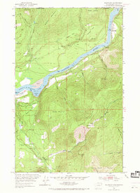
1952 Map of Boundary
USGS Topo · Published 1969About this map
The Canada United States border defines the northern edge of this landscape, where the Columbia River flows southward into Franklin D Roosevelt Lake. This mid-century survey captures the region's industrial and residential transition, showing the Great Northern railroad line hugging the riverbank alongside local landmarks like Stroh Spur and the Gaging Sta. The terrain is marked by steep elevation gains up Mitchell Mountain and Stone Mountain, contrasting with the more level Mitchell Flat and Becker Flat.
Find a feature on this map
45 named features on this map. Tap any name to fly to it.
Don’t see what you’re looking for? This feature index may not catch every label — zoom into the map to look around manually.
Map Details
Editions of this 1952 Boundary Map
3 editions found
Other maps of this area

1929 · Colville
USGS Topo · 1:125,000

1933 · Colville
USGS Topo · 1:125,000

1952 · Spirit
USGS Topo · 1:24,000

1952 · Deep Lake
USGS Topo · 1:24,000

1952 · Leadpoint
USGS Topo · 1:24,000

1952 · Boundary
USGS Topo · 1:24,000

1958 · Sandpoint
USGS Topo · 1:250,000

1963 · Sandpoint
USGS Topo · 1:250,000
1969 · Onion Creek
USGS Topo · 1:24,000
1969 · Northport
USGS Topo · 1:24,000