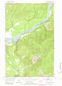
1952 Map of Boundary
USGS Topo · Published 1982About this map
Columbia River waters flow through a landscape defined by the international border and mid-century industrial utility. The river, widened by the downstream Grand Coulee Dam, forms Franklin D Roosevelt Lake in the south, with notable features like Deadmans Eddy and Steamboat Rock marking the waterway. This rugged frontier terrain is bisected by the Great Northern railroad and a primary Highway, supporting a scattering of remote settlements and institutions.
Find a feature on this map
45 named features on this map. Tap any name to fly to it.
Don’t see what you’re looking for? This feature index may not catch every label — zoom into the map to look around manually.
Map Details
Editions of this 1952 Boundary Map
3 editions found
Other maps of this area

1929 · Colville
USGS Topo · 1:125,000

1933 · Colville
USGS Topo · 1:125,000

1952 · Spirit
USGS Topo · 1:24,000

1952 · Deep Lake
USGS Topo · 1:24,000

1952 · Leadpoint
USGS Topo · 1:24,000

1952 · Boundary
USGS Topo · 1:24,000

1958 · Sandpoint
USGS Topo · 1:250,000

1963 · Sandpoint
USGS Topo · 1:250,000
1969 · Onion Creek
USGS Topo · 1:24,000
1969 · Northport
USGS Topo · 1:24,000