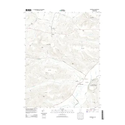
2013 Map of Bourneville
USGS Topo · Published 2013About this map
Hopewell Culture National Historical Park anchors the eastern edge of this landscape, preserving significant earthworks along the broad valley of Paint Creek. The map documents the rural character of Ross County in the early 21st century, centered on the unincorporated community of Bourneville near the junction of Us-50 and Paint Creek. The topography is defined by a series of prominent ridges and hollows, including Plyley Ridge, Barger Ridge, and California Hollow, which dictate the winding paths of local routes like Lower Twin Rd and Spargursville Rd. Extensive genealogical data is present through several historic burial sites such as Twin Township Cem and Sheron Cem, alongside smaller settlements like Lattaville and Musselman. The drainage patterns of Upper Twin Cr and Lower Twin Cr illustrate the complex watershed that feeds into the larger North Fork Paint Creek system.
Find a feature on this map
63 named features on this map. Tap any name to fly to it.
Don’t see what you’re looking for? This feature index may not catch every label — zoom into the map to look around manually.
Map Details
Editions of this 2013 Bourneville Map
This is the sole edition of this map. No revisions or reprints were ever made.
Other maps of this area

1912 · Roxabell
USGS Topo · 1:62,500

1914 · Roxabell
USGS Topo · 1:62,500

1915 · Bainbridge
USGS Topo · 1:48,000

1915 · Piketon
USGS Topo · 1:62,500

1917 · Bainbridge
USGS Topo · 1:62,500

1917 · Piketon
USGS Topo · 1:62,500

1917 · Greenfield
USGS Topo · 1:62,500

1944 · Piketon
USGS Topo · 1:62,500

1944 · Greenfield
USGS Topo · 1:62,500

1944 · Roxabell
USGS Topo · 1:62,500