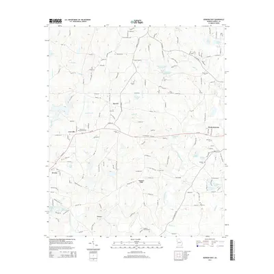
2014 Map of Bowdon East
USGS Topo · Published 2014About this map
Little Tallapoosa River meanders through the central and southern portions of this landscape, serving as a primary drainage for a territory defined by small agricultural settlements and rural church communities. The area around Farmers High and Victory maintains a distinct rural character, with family-named cemeteries such as Lees Chapel Cem and Shiloh Cem providing critical points of reference for local genealogy. The presence of John Tanner State Park and its accompanying lakes, John Tanner State Park Lake A and John Tanner State Park Lake B, indicates a transition toward managed recreation alongside traditional farming. Aviation history is noted by the presence of the Flying W Farms Airport in the south, while the network of county roads like Lovvorn Rd and Burwell Rd connects longstanding locales such as Burwell and Jonesville.
Find a feature on this map
135 named features on this map. Tap any name to fly to it.
Don’t see what you’re looking for? This feature index may not catch every label — zoom into the map to look around manually.
Map Details
Editions of this 2014 Bowdon East Map
This is the sole edition of this map. No revisions or reprints were ever made.
Other maps of this area

1889 · Tallapoosa
USGS Topo · 1:125,000

1892 · Tallapoosa
USGS Topo · 1:125,000

1897 · Tallapoosa
USGS Topo · 1:125,000

1899 · Wedowee
USGS Topo · 1:125,000

1902 · Wedowee
USGS Topo · 1:125,000

1953 · Atlanta
USGS Topo · 1:250,000

1957 · Atlanta
USGS Topo · 1:250,000

1958 · Atlanta
USGS Topo · 1:250,000

1958 · Carrollton
USGS Topo · 1:62,500

1964 · Roopville
USGS Topo · 1:24,000