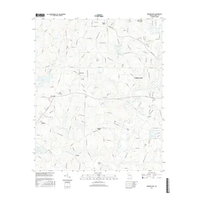
2017 Map of Bowdon East
USGS Topo · Published 2017About this map
Carrollton and the surrounding agricultural uplands are defined by the winding course of the Little Tallapoosa River and a dense network of local routes like Lovvorn Rd and Mount Zion Rd. This 2017 survey reveals the established rural communities of Mount Zion, Burwell, and Farmers High, each anchored by historical gathering places and small family-named landmarks. The landscape is dotted with numerous burial grounds of genealogical importance, including Smith Chapel Cem and Lees Chapel Cem, alongside newer developments such as Rolling Acres Memory Gardens. Recreation and regional infrastructure are central to the area's modern character, seen in the dual basins of John Tanner State Park Lake A and John Tanner State Park Lake B and the proximity of the West Georgia Regional Airport. Small tributaries like Turkey Cr and Garrett Cr segment the terrain, linking together dozens of private ponds and larger bodies like Shadinger Lake.
Find a feature on this map
163 named features on this map. Tap any name to fly to it.
Don’t see what you’re looking for? This feature index may not catch every label — zoom into the map to look around manually.
Map Details
Editions of this 2017 Bowdon East Map
This is the sole edition of this map. No revisions or reprints were ever made.
Other maps of this area

1889 · Tallapoosa
USGS Topo · 1:125,000

1892 · Tallapoosa
USGS Topo · 1:125,000

1897 · Tallapoosa
USGS Topo · 1:125,000

1899 · Wedowee
USGS Topo · 1:125,000

1902 · Wedowee
USGS Topo · 1:125,000

1953 · Atlanta
USGS Topo · 1:250,000

1957 · Atlanta
USGS Topo · 1:250,000

1958 · Atlanta
USGS Topo · 1:250,000

1958 · Carrollton
USGS Topo · 1:62,500

1964 · Roopville
USGS Topo · 1:24,000