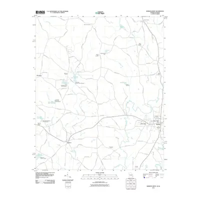
2011 Map of Bowdon West
USGS Topo · Published 2011About this map
Bowdon stands as the primary hub in this Georgia-Alabama borderland, where the terrain is defined by the headwaters of the Little Tallapoosa River. The landscape is a network of small watersheds, most notably the Lost Creek system, which features a series of managed reservoirs such as Lost Creek Lake Number 1 and Lost Creek Lake Number 4. These water management structures, including the Stitcher Lake Dam, underscore the region's agricultural and hydrological development.
Find a feature on this map
106 named features on this map. Tap any name to fly to it.
Don’t see what you’re looking for? This feature index may not catch every label — zoom into the map to look around manually.
Map Details
Editions of this 2011 Bowdon West Map
This is the sole edition of this map. No revisions or reprints were ever made.
Other maps of this area

1889 · Tallapoosa
USGS Topo · 1:125,000

1892 · Tallapoosa
USGS Topo · 1:125,000

1897 · Tallapoosa
USGS Topo · 1:125,000

1899 · Wedowee
USGS Topo · 1:125,000

1902 · Wedowee
USGS Topo · 1:125,000

1953 · Atlanta
USGS Topo · 1:250,000

1957 · Atlanta
USGS Topo · 1:250,000

1958 · Atlanta
USGS Topo · 1:250,000

1958 · Carrollton
USGS Topo · 1:62,500

1964 · Roopville
USGS Topo · 1:24,000