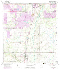
1955 Map of Bowling Green
USGS Topo · Published 1983About this map
Industrial excavations and rural settlements define the border between Polk Co and Hardee Co during this mid-century period. The landscape is heavily marked by phosphate extraction, with numerous Strip Mines and large Tailings Ponds appearing alongside the Seaboard Coast Line railroad. In the northern reaches, Fort Meade serves as a primary hub, supported by the Fort Meade Cem and Peace River Ch.
Find a feature on this map
20 named features on this map. Tap any name to fly to it.
Don’t see what you’re looking for? This feature index may not catch every label — zoom into the map to look around manually.
Map Details
Editions of this 1955 Bowling Green Map
4 editions found
Other maps of this area

1949 · Bradley Junction
USGS Topo · 1:24,000

1950 · Bradley Junction
USGS Topo · 1:24,000

1952 · Homeland
USGS Topo · 1:24,000

1955 · Ft. Green
USGS Topo · 1:24,000

1955 · Bowling Green
USGS Topo · 1:24,000

1955 · Wauchula
USGS Topo · 1:24,000

1955 · Baird
USGS Topo · 1:24,000

1955 · Alturas
USGS Topo · 1:24,000

1956 · Bereah
USGS Topo · 1:24,000

1956 · Griffins Corner
USGS Topo · 1:24,000