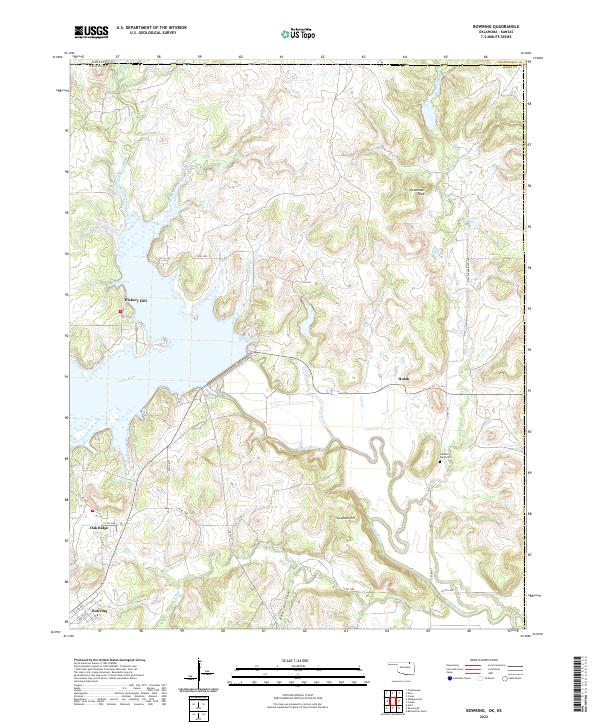
2022 Map of Bowring
USGS Topo · Published 2022About this map
Bowring serves as the primary settlement in this northern Osage County landscape, where the Caney River dictates the local topography before flowing toward the border of Kansas and Oklahoma. The river valley is defined by significant hydrological features including Quarry Cove and Tucker Cove, which emphasize the modified nature of the waterway. Notable family history and local landmarks are preserved on this survey, such as the Labadie Family Cem and the eponymous Mullendore Ranch Rd, alongside prominent terrain features like Deadmans Rock and Sundown Hill. The map also details small crossroads communities like Hulah and Oak Ridge, while the drainage network of Mission Creek, Skull Creek, and Opossum Creek provides a clear view of the watershed patterns that shaped early ranching and agriculture in the region.
Find a feature on this map
39 named features on this map. Tap any name to fly to it.
Don’t see what you’re looking for? This feature index may not catch every label — zoom into the map to look around manually.
Map Details
Editions of this 2022 Bowring Map
This is the sole edition of this map. No revisions or reprints were ever made.
Other maps of this area

1885 · Sedan
USGS Topo · 1:125,000

1886 · Independence
USGS Topo · 1:125,000

1889 · Sedan
USGS Topo · 1:125,000

1894 · Independence
USGS Topo · 1:125,000

1901 · Nowata
USGS Topo · 1:125,000

1905 · Independence
USGS Topo · 1:125,000

1909 · Pawhuska
USGS Topo · 1:125,000

1910 · Pawhuska
USGS Topo · 1:125,000

1914 · Nowata
USGS Topo · 1:125,000

1947 · Joplin
USGS Topo · 1:250,000