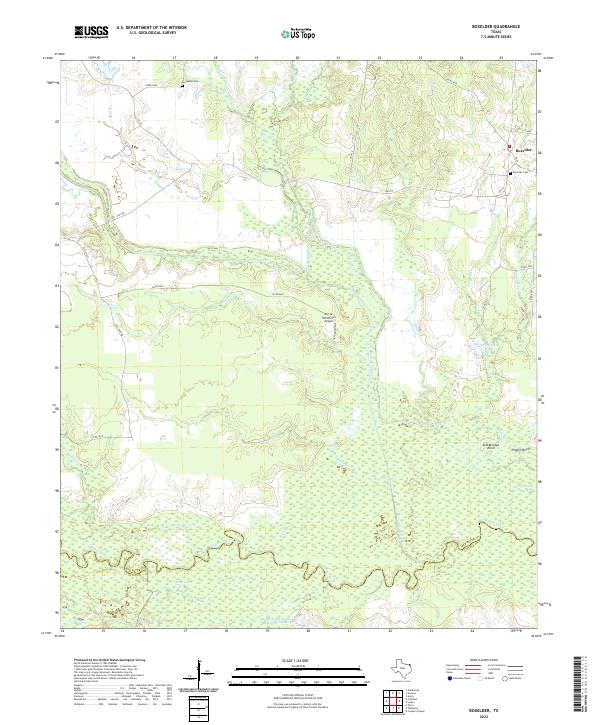
2022 Map of Boxelder
USGS Topo · Published 2022About this map
The Sulphur River forms the southern boundary of this landscape, winding through a complex network of wetlands and seasonal watercourses in northeast Texas. The settlement of Boxelder sits at the northeastern corner of the map, anchored by the Boxelder Cem and connected by FM 44. To the west, the Circle WC Ranch Airport suggests the modern integration of aviation into rural ranching operations. The terrain is defined by its subtle drainage patterns, where Cuthand Creek and the Big Slough meander through low-lying areas punctuated by named rises like Stockbridge Knoll and Pigpen Knoll.
Find a feature on this map
39 named features on this map. Tap any name to fly to it.
Don’t see what you’re looking for? This feature index may not catch every label — zoom into the map to look around manually.
Map Details
Editions of this 2022 Boxelder Map
This is the sole edition of this map. No revisions or reprints were ever made.
Other maps of this area

1950 · Annona
USGS Topo · 1:24,000

1951 · Annona
USGS Topo · 1:24,000

1951 · Avery
USGS Topo · 1:24,000

1953 · Texarkana
USGS Topo · 1:250,000

1956 · Texarkana
USGS Topo · 1:250,000

1964 · Cuthand
USGS Topo · 1:24,000

1964 · Wilkinson
USGS Topo · 1:24,000

1964 · Talco
USGS Topo · 1:24,000
1964 · Clarksville
USGS Topo · 1:24,000

1965 · Lydia
USGS Topo · 1:24,000