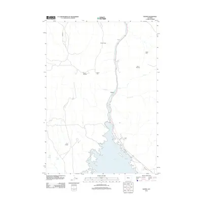
2012 Map of Boysen
USGS Topo · Published 2012About this map
Boysen and Dornick occupy the narrow corridors where the Wind River flows through the high desert of Fremont County. The landscape is defined by the massive Boysen Reservoir, a significant water feature that dominates the southern portion of the area. Rugged elevations surround the water, including Boysen Peak, Stagner Mountain, and the prominent Boysen Ridge that runs parallel to the river.
Find a feature on this map
17 named features on this map. Tap any name to fly to it.
Don’t see what you’re looking for? This feature index may not catch every label — zoom into the map to look around manually.
Map Details
Editions of this 2012 Boysen Map
This is the sole edition of this map. No revisions or reprints were ever made.
Other maps of this area

1950 · Bonneville SW
USGS Topo · 1:24,000

1951 · Mexican Pass SE
USGS Topo · 1:24,000

1951 · Boysen
USGS Topo · 1:24,000

1951 · Birdseye Pass
USGS Topo · 1:24,000

1951 · Morrison Canyon
USGS Topo · 1:24,000

1951 · Bonneville
USGS Topo · 1:24,000

1955 · Thermopolis
USGS Topo · 1:250,000
1957 · Bonneville
USGS Topo · 1:24,000

1958 · Thermopolis
USGS Topo · 1:250,000
1958 · Mexican Pass SE
USGS Topo · 1:24,000