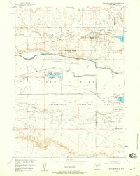
1958 Map of Mexican Pass SE
USGS Topo · Published 1959About this map
The Wind River Indian Reservation dominates the northern landscape of this 1958 survey, where the waters of Cottonwood Creek flow toward the Boysen Reservation Withdrawal Area. This region reflects a complex history of land and water management, illustrated by the extensive Riverton Reclamation Withdrawal Area and the engineered paths of the Wyoming Canal and Cottonwood Drain.
Find a feature on this map
24 named features on this map. Tap any name to fly to it.
Don’t see what you’re looking for? This feature index may not catch every label — zoom into the map to look around manually.
Map Details
Editions of this 1958 Mexican Pass SE Map
2 editions found
Other maps of this area

1950 · Mexican Pass SW
USGS Topo · 1:24,000

1950 · Bonneville SW
USGS Topo · 1:24,000

1951 · Mexican Pass SE
USGS Topo · 1:24,000

1951 · Boysen
USGS Topo · 1:24,000

1951 · Mexican Pass
USGS Topo · 1:24,000

1951 · Morrison Canyon
USGS Topo · 1:24,000

1951 · Hidden Valley
USGS Topo · 1:24,000

1952 · Riverton NE
USGS Topo · 1:24,000

1952 · Lost Wells Butte
USGS Topo · 1:24,000

1955 · Thermopolis
USGS Topo · 1:250,000