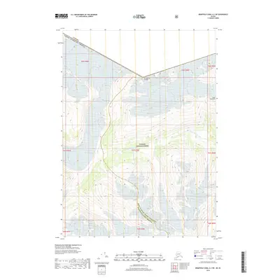
2018 Map of Bradfield Canal A-1 SW
USGS Topo · Published 2018About this map
Mt Jefferson Coolidge stands as a prominent landmark along the international boundary where the Canada United States of America border cuts through the high reaches of the Coast Mountains. This 2018 survey captures a glaciated landscape defined by significant ice and water features, including the expansive Casey Glacier in the southern portion of the quadrangle. The area is part of the Tongass National Forest, illustrating the remote wilderness character of the Alaska-British Columbia frontier. Water systems like Texas Lake and the drainage of W Fork Texas Cr and Ibex Cr trace the paths of glacial melt through the steep elevations. The map also delineates the administrative boundary between the Prince of Wales - Hyder Census Area and Ketchikan Gateway Borough, marking a remote intersection of local and international jurisdictions.
Find a feature on this map
17 named features on this map. Tap any name to fly to it.
Don’t see what you’re looking for? This feature index may not catch every label — zoom into the map to look around manually.
Map Details
Editions of this 2018 Bradfield Canal A-1 SW Map
This is the sole edition of this map. No revisions or reprints were ever made.
Other maps of this area

1951 · Bradfield Canal
USGS Topo · 1:250,000

1952 · Ketchikan
USGS Topo · 1:250,000

1954 · Bradfield Canal
USGS Topo · 1:250,000

1955 · Ketchikan D-2
USGS Topo · 1:63,360

1955 · Bradfield canal A-2
USGS Topo · 1:63,360

1955 · Bradfield Canal A-1
USGS Topo · 1:63,360

1955 · Ketchikan D-1
USGS Topo · 1:63,360

1955 · Ketchikan
USGS Topo · 1:250,000

1955 · Bradfield Canal
USGS Topo · 1:250,000
1996 · Bradfield Canal A-1
USGS Topo · 1:63,360