
1955 Map of Bradfield canal B-3
USGS Topo · Published 1959About this map
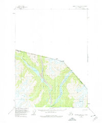
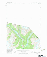
Tongass National Forest dominates this mid-century topographic study of the remote Alaskan wilderness bordering British Columbia. The landscape is defined by the significant glacial and fluvial systems of the Blue River valley, where the water flows through narrow passages like First Canyon and past the distinctive Lava formations. High-altitude features including Mt Stoeckl, Dickins Pk, and Mosheim Dome provide steep relief, with Crevasses marked on the ice-laden slopes. A singular Cable Car installation near the river indicates the difficulty of traversing this terrain before modern infrastructure. This 1950s survey reflects the ongoing work of the International Boundary Commission along the Canada United States border, capturing the drainage patterns of Blue Lake and Hell Roaring Creek in a period of active aerial photogrammetric mapping.
Find a feature on this map
15 named features on this map. Tap any name to fly to it.
Don’t see what you’re looking for? This feature index may not catch every label — zoom into the map to look around manually.
Map Details
Editions of this 1955 Bradfield canal B-3 Map
3 editions found
Other maps of this area

1951 · Bradfield Canal
USGS Topo · 1:250,000

1954 · Bradfield Canal
USGS Topo · 1:250,000

1955 · Bradfield canal B-2
USGS Topo · 1:63,360

1955 · Bradfield canal A-4
USGS Topo · 1:63,360

1955 · Bradfield canal A-2
USGS Topo · 1:63,360

1955 · Bradfield canal B-4
USGS Topo · 1:63,360

1955 · Bradfield canal A-3
USGS Topo · 1:63,360

1955 · Bradfield Canal
USGS Topo · 1:250,000
1973 · Bradfield Canal B-2
USGS Topo · 1:63,360
1995 · Bradfield Canal A-4
USGS Topo · 1:63,360