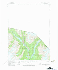
1955 Map of Bradfield canal B-3
USGS Topo · Published 1983About this map
The Tongass National Forest along the international boundary between British Columbia and Alaska is defined here by its massive glacial systems and high peaks. This 1955 survey, based on 1948 aerial photography, records a landscape dominated by the convergence of the Unuk River and the Blue River. The drainage patterns reveal the presence of Lava flows near First Canyon and the expansive waters of Blue Lake.
Find a feature on this map
15 named features on this map. Tap any name to fly to it.
Don’t see what you’re looking for? This feature index may not catch every label — zoom into the map to look around manually.
Map Details
Editions of this 1955 Bradfield canal B-3 Map
3 editions found
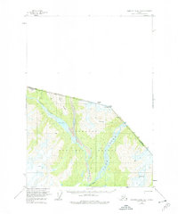
Other maps of this area

1951 · Bradfield Canal
USGS Topo · 1:250,000

1954 · Bradfield Canal
USGS Topo · 1:250,000

1955 · Bradfield canal B-2
USGS Topo · 1:63,360

1955 · Bradfield canal B-3
USGS Topo · 1:63,360

1955 · Bradfield canal A-4
USGS Topo · 1:63,360

1955 · Bradfield canal A-2
USGS Topo · 1:63,360

1955 · Bradfield canal B-4
USGS Topo · 1:63,360

1955 · Bradfield canal A-3
USGS Topo · 1:63,360

1955 · Bradfield Canal
USGS Topo · 1:250,000
1973 · Bradfield Canal B-2
USGS Topo · 1:63,360