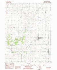
1983 Map of Bradford
USGS Topo · Published 1984About this map
The prairie landscape of Stark and Bureau counties centers on Bradford, a village defined by the intersection of the Burlington Northern railroad and several local arterial roads like Main St. This early 1980s survey illustrates a rural region anchored by small-scale agrarian infrastructure and long-standing community centers. The town of Bradford itself is home to the Apostolic Ch and Hodges Park, reflecting a traditional Midwestern settlement pattern where the village core serves the surrounding farmsteads.
Find a feature on this map
32 named features on this map. Tap any name to fly to it.
Don’t see what you’re looking for? This feature index may not catch every label — zoom into the map to look around manually.
Map Details
Editions of this 1983 Bradford Map
2 editions found
Other maps of this area

1921 · Buda
USGS Topo · 1:62,500

1923 · Buda
USGS Topo · 1:62,500

1929 · Annawan
USGS Topo · 1:62,500

1932 · Annawan
USGS Topo · 1:62,500

1933 · Camp Grove
USGS Topo · 1:48,000

1944 · Kewanee
USGS Topo · 1:62,500

1945 · Bradford
USGS Topo · 1:62,500

1958 · Aurora
USGS Topo · 1:250,000

1961 · Aurora
USGS Topo · 1:250,000
1983 · Castleton
USGS Topo · 1:24,000