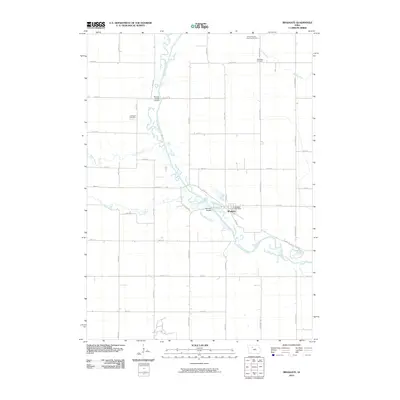
2010 Map of Bradgate
USGS Topo · Published 2010About this map
The Des Moines River carves a winding path through this corner of Humboldt County, creating a riparian corridor that contrasts with the surrounding agricultural grid. Near the center of the sheet, the town of Bradgate serves as a local hub, anchored by the Bradgate Post Office. This map captures a landscape where river access points like Hamms Bridge Access and Willows Access provide recreation and transit alongside productive farmland.
Find a feature on this map
40 named features on this map. Tap any name to fly to it.
Don’t see what you’re looking for? This feature index may not catch every label — zoom into the map to look around manually.
Map Details
Editions of this 2010 Bradgate Map
This is the sole edition of this map. No revisions or reprints were ever made.
Other maps of this area

1954 · Fort Dodge
USGS Topo · 1:250,000

1957 · Fort Dodge
USGS Topo · 1:250,000

1958 · Fort Dodge
USGS Topo · 1:250,000

1979 · Unique
USGS Topo · 1:24,000

1979 · Gilmore City
USGS Topo · 1:24,000

1979 · Palmer
USGS Topo · 1:24,000

1980 · Rolfe
USGS Topo · 1:24,000

1980 · Plover
USGS Topo · 1:24,000

1980 · West Bend
USGS Topo · 1:24,000
1980 · Bode
USGS Topo · 1:24,000