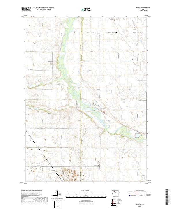
2022 Map of Bradgate
USGS Topo · Published 2022About this map
Bradgate sits at the convergence of several waterways, dominated by the winding course of the Des Moines River as it passes through the heart of the region. The landscape is defined by the rural grid of Pocahontas and Humboldt counties, where small pioneer burial grounds like Old Rolfe Cem and the Omer-Thorsen Farm Cem remain as quiet markers of early settlement history. The terrain is notably water-heavy, featuring managed drainage through Ditch Number 7 and natural tributaries such as Bloody Run and Beaver Cr. Modern recreation has reclaimed parts of the former transit corridors, most notably seen in the Three Rivers Trl which parallels the river. This survey captures the steady agricultural character of north-central Iowa, documenting the section lines and rural road networks that have structured the area for generations, from King St in town out to the county line at Arizona Ave.
Find a feature on this map
51 named features on this map. Tap any name to fly to it.
Don’t see what you’re looking for? This feature index may not catch every label — zoom into the map to look around manually.
Map Details
Editions of this 2022 Bradgate Map
This is the sole edition of this map. No revisions or reprints were ever made.
Other maps of this area

1954 · Fort Dodge
USGS Topo · 1:250,000

1957 · Fort Dodge
USGS Topo · 1:250,000

1958 · Fort Dodge
USGS Topo · 1:250,000

1979 · Unique
USGS Topo · 1:24,000

1979 · Gilmore City
USGS Topo · 1:24,000

1979 · Palmer
USGS Topo · 1:24,000

1980 · Rolfe
USGS Topo · 1:24,000

1980 · Plover
USGS Topo · 1:24,000

1980 · West Bend
USGS Topo · 1:24,000
1980 · Bode
USGS Topo · 1:24,000