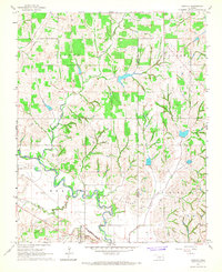
1966 Map of Bradley
USGS Topo · Published 1967About this map
The Washita River snakes through this 1960s landscape, defining the topography of the Bradley area. This period is marked by an extensive industrial footprint, where the town is surrounded by the Northeast Bradley Oil Field, Northwest Bradley Oil Field, and the significant Golden Trend Oil Field. The presence of numerous oil wells and a Gravel Pit indicates a heavy reliance on natural resource extraction during this era.
Find a feature on this map
17 named features on this map. Tap any name to fly to it.
Don’t see what you’re looking for? This feature index may not catch every label — zoom into the map to look around manually.
Map Details
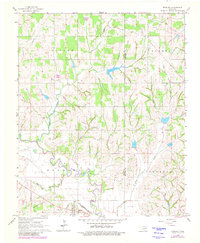
Editions of this 1966 Bradley Map
2 editions found
Other maps of this area

1902 · Rush Springs
USGS Topo · 1:125,000

1904 · Chickasha
USGS Topo · 1:125,000

1949 · Rush Springs
USGS Topo · 1:62,500

1950 · Rush Springs
USGS Topo · 1:62,500

1954 · Oklahoma City
USGS Topo · 1:250,000

1957 · Ardmore
USGS Topo · 1:250,000

1957 · Oklahoma City
USGS Topo · 1:250,000

1963 · Ardmore
USGS Topo · 1:250,000

1963 · Oklahoma City
USGS Topo · 1:250,000
1965 · Cole
USGS Topo · 1:24,000