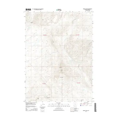
2015 Map of Bradley Peak
USGS Topo · Published 2015About this map
Bradley Peak and the Seminoe Mountains dominate this high-elevation Wyoming landscape, where the topography transitions from steep summits into the broad Pattison Basin. This modern survey illustrates a rugged expanse defined by its intricate drainage systems, including Bothwell Cr and Sand Cr, which carve through features like Sand Creek Canyon. The map reveals a land utilized for resource extraction and navigation, evidenced by the presence of Fieldhouse Cut and Coal Springs Draw near the southern boundary. Remote access is tracked through primitive routes like Sunday Morning Rd, while distinctive landmarks such as Bear Mtn and Junk Hill provide essential navigational markers for researchers and surveyors. The absence of major settlements underscores the isolated, high-desert character of this portion of Carbon County.
Find a feature on this map
31 named features on this map. Tap any name to fly to it.
Don’t see what you’re looking for? This feature index may not catch every label — zoom into the map to look around manually.
Map Details
Editions of this 2015 Bradley Peak Map
This is the sole edition of this map. No revisions or reprints were ever made.
Other maps of this area

1953 · Bradley Peak
USGS Topo · 1:24,000

1953 · Seminoe Dam
USGS Topo · 1:24,000

1953 · Wild Horse Mountain
USGS Topo · 1:24,000

1953 · Seminoe Dam SW
USGS Topo · 1:24,000

1953 · Ferris
USGS Topo · 1:24,000

1953 · Pathfinder Reservoir SW
USGS Topo · 1:24,000

1953 · Buzzard Ranch
USGS Topo · 1:24,000

1953 · Spanish Mine
USGS Topo · 1:24,000

1953 · Riddle Cut
USGS Topo · 1:24,000

1955 · Casper
USGS Topo · 1:250,000