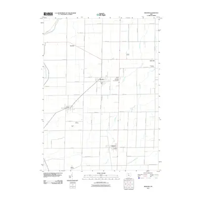
2010 Map of Bradner
USGS Topo · Published 2010About this map
Bradner and its surrounding Wood County landscape are defined by a rhythmic grid of rural roads and the meandering paths of several significant waterways. Small agricultural hubs like Rollersville, Risingsun, and Wayne are linked by a network of routes such as Greensburg Pike and Bradner Rd. The land is drained by a complex hydraulic system including Schwan Creek, Sugar Creek, and the South Branch Portage River. Local industry and land use are represented by features like Haslinger Orchards and the Church Camp near Graham Cemetery. Genealogists will find this 2010 survey particularly valuable for its clear marking of local burial sites, including the Saint Jacobs Evangelical Lutheran Cemetery and the more remote Pember Farm Cemetery. Each settlement is anchored by its civic center, from the Bradner Post Office to the southern reach of Hatton.
Find a feature on this map
59 named features on this map. Tap any name to fly to it.
Don’t see what you’re looking for? This feature index may not catch every label — zoom into the map to look around manually.
Map Details
Editions of this 2010 Bradner Map
This is the sole edition of this map. No revisions or reprints were ever made.
Other maps of this area

1901 · Fostoria
USGS Topo · 1:62,500

1901 · Bowling Green
USGS Topo · 1:62,500

1901 · Elmore
USGS Topo · 1:62,500

1903 · Bowling Green
USGS Topo · 1:62,500

1903 · Fostoria
USGS Topo · 1:62,500

1903 · Findlay
USGS Topo · 1:62,500

1903 · Elmore
USGS Topo · 1:62,500

1956 · Toledo
USGS Topo · 1:250,000
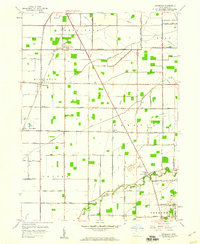
1958 · Dunbridge
USGS Topo · 1:24,000

1958 · Jerry City
USGS Topo · 1:24,000