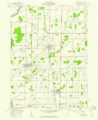
1958 Map of Bradner
USGS Topo · Published 1960About this map
The agricultural plains of northwestern Ohio are defined here by a dense grid of section roads and a sprawling network of Oil Wells, particularly concentrated around the village of Bradner. This 1958 survey captures the region's mid-century character, where heavy rail traffic from the New York Central and the Chesapeake and Ohio railroads intersects at the hearts of small trading hubs like Wayne and Risingsun. Local landmarks such as the Township Sch and Graham Cem provide specific points of interest for genealogical research, anchoring the landscape's history to its early schools and family burial sites.
Find a feature on this map
48 named features on this map. Tap any name to fly to it.
Don’t see what you’re looking for? This feature index may not catch every label — zoom into the map to look around manually.
Map Details
Editions of this 1958 Bradner Map
This is the sole edition of this map. No revisions or reprints were ever made.
Other maps of this area

1901 · Fostoria
USGS Topo · 1:62,500

1901 · Bowling Green
USGS Topo · 1:62,500

1901 · Elmore
USGS Topo · 1:62,500

1903 · Bowling Green
USGS Topo · 1:62,500

1903 · Fostoria
USGS Topo · 1:62,500

1903 · Findlay
USGS Topo · 1:62,500

1903 · Elmore
USGS Topo · 1:62,500

1956 · Toledo
USGS Topo · 1:250,000
1958 · Dunbridge
USGS Topo · 1:24,000

1958 · Jerry City
USGS Topo · 1:24,000