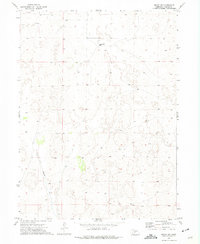
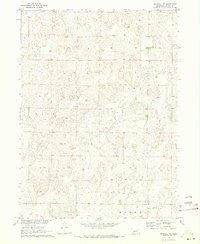
1972 Map of Brady NW
USGS Topo · Published 1975About this map
Pawnee Springs Ranch sits in the northern reaches of this section of Lincoln County, marking the sparse human footprint on the Nebraska plains during the early 1970s. The landscape is defined by the ephemeral path of Pawnee Creek, which winds southward through a terrain marked by thousands of small depressions and sand dunes. This 1972 aerial survey, field-checked the same year, documents a ranching economy where water is the primary concern for land use. Beyond the main ranch, a solitary Well is noted to the west, emphasizing the reliance on groundwater in this arid environment. The map provides a precise record of section lines and fence boundaries, illustrating how the vast Nebraska range was partitioned and managed by local landowners during this era.
Find a feature on this map
3 named features on this map. Tap any name to fly to it.
Don’t see what you’re looking for? This feature index may not catch every label — zoom into the map to look around manually.
Map Details
Editions of this 1972 Brady NW Map
This is the sole edition of this map. No revisions or reprints were ever made.
Other maps of this area

1899 · North Platte
USGS Topo · 1:125,000

1902 · North Platte
USGS Topo · 1:125,000

1954 · North Platte
USGS Topo · 1:250,000

1956 · North Platte
USGS Topo · 1:250,000

1957 · North Platte
USGS Topo · 1:250,000

1967 · North Platte
USGS Topo · 1:250,000
1970 · Brady SW
USGS Topo · 1:24,000
1970 · Maxwell
USGS Topo · 1:24,000
1970 · Brady
USGS Topo · 1:24,000
1970 · Maxwell NE
USGS Topo · 1:24,000