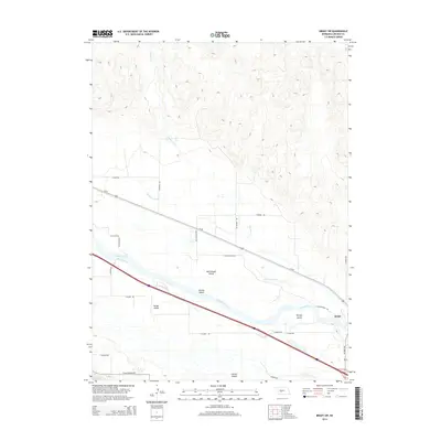
2014 Map of Brady SW
USGS Topo · Published 2014About this map
The Platte River meanders across this Central Nebraska landscape, defining a complex network of channels and braided sandbars in the vicinity of Brady. The topography is dominated by large, named landforms within the river's path, including Brady Island, Chester Island, and McCullough Island. These features illustrate the historical shifting of the riverbed and the reliance on specific crossings and island agriculture in Lincoln County. To the north, the land rises away from the floodplain toward the drainage of Pawnee Cr, while the lowland area is marked by the Pawnee Slough. This 2014 survey documents the modern transportation corridors that parallel the river, including Us-30 and historic routes like Ft McPherson Rd, which points to the area's frontier military history. The grid of rural roads, such as Haythorn Rd and McCullough Rd, underscores the organized agricultural development of the Platte Valley.
Find a feature on this map
26 named features on this map. Tap any name to fly to it.
Don’t see what you’re looking for? This feature index may not catch every label — zoom into the map to look around manually.
Map Details
Editions of this 2014 Brady SW Map
This is the sole edition of this map. No revisions or reprints were ever made.
Other maps of this area

1899 · North Platte
USGS Topo · 1:125,000

1902 · Gothenburg
USGS Topo · 1:125,000

1902 · North Platte
USGS Topo · 1:125,000

1954 · McCook
USGS Topo · 1:250,000

1954 · North Platte
USGS Topo · 1:250,000

1956 · North Platte
USGS Topo · 1:250,000

1956 · Wellfleet NE
USGS Topo · 1:24,000

1957 · North Platte
USGS Topo · 1:250,000

1957 · McCook
USGS Topo · 1:250,000

1958 · McCook
USGS Topo · 1:250,000