
1935 Map of Branch
USGS Topo · Published 1935About this map
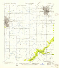
Brule Bayou Plaquemine and Wikoff Bayou carve through the agricultural landscape of Acadia Parish in this mid-1930s survey. The map reveals a deeply established rural community defined by its drainage gullies and a network of schools and churches that served scattered homesteads. Educational life is anchored by facilities such as Link Sch, Prather Sch, and Black Sch, while local worship centered on Maryland Chapel and Mt Calvary Ch.
Find a feature on this map
23 named features on this map. Tap any name to fly to it.
Don’t see what you’re looking for? This feature index may not catch every label — zoom into the map to look around manually.
Map Details
Editions of this 1935 Branch Map
This is the sole edition of this map. No revisions or reprints were ever made.
Other maps of this area

1934 · Duson
USGS Topo · 1:31,680

1946 · Rayne
USGS Topo · 1:31,680

1947 · Branch
USGS Topo · 1:31,680

1947 · Eunice
USGS Topo · 1:31,680

1947 · Iota
USGS Topo · 1:31,680

1947 · Pitreville
USGS Topo · 1:31,680

1949 · Estherwood
USGS Topo · 1:31,680

1952 · Lake Charles
USGS Topo · 1:250,000

1954 · Duson
USGS Topo · 1:31,680
1954 · Rayne
USGS Topo · 1:31,680