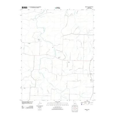
2011 Map of Branch
USGS Topo · Published 2011About this map
The Little Niangua River winds across this section of Hickory County, anchoring a landscape of small settlements and rural infrastructure. The community of Almon sits near the river's upper reaches, while the village of Branch is situated to the east near the Branch Lookout Tower. This 2011 survey captures the area's agricultural and hydraulic history through features like Parks Mill and the Carpenter Lake Dam on Carpenter Lake. Local genealogy is preserved in the locations of the Little Niangua Cemetery and Stanton Cemetery, which serve as quiet markers of the region's long-standing families. A complex network of drainage basins, including Macks Creek, Cahoochie Creek, and multiple spans of Long Branch, defines the local topography, which remains characterized by its dense system of county roads and named creek branches.
Find a feature on this map
66 named features on this map. Tap any name to fly to it.
Don’t see what you’re looking for? This feature index may not catch every label — zoom into the map to look around manually.
Map Details
Editions of this 2011 Branch Map
This is the sole edition of this map. No revisions or reprints were ever made.
Other maps of this area

1884 · Bolivar
USGS Topo · 1:125,000

1887 · Warsaw
USGS Topo · 1:125,000

1888 · Versailles
USGS Topo · 1:125,000

1892 · Bolivar
USGS Topo · 1:125,000

1893 · Versailles
USGS Topo · 1:125,000

1894 · Warsaw
USGS Topo · 1:125,000

1934 · Macks Creek
USGS Topo · 1:48,000

1935 · Barnumton
USGS Topo · 1:24,000

1939 · Macks Creek
USGS Topo · 1:62,500

1947 · Jefferson City
USGS Topo · 1:250,000