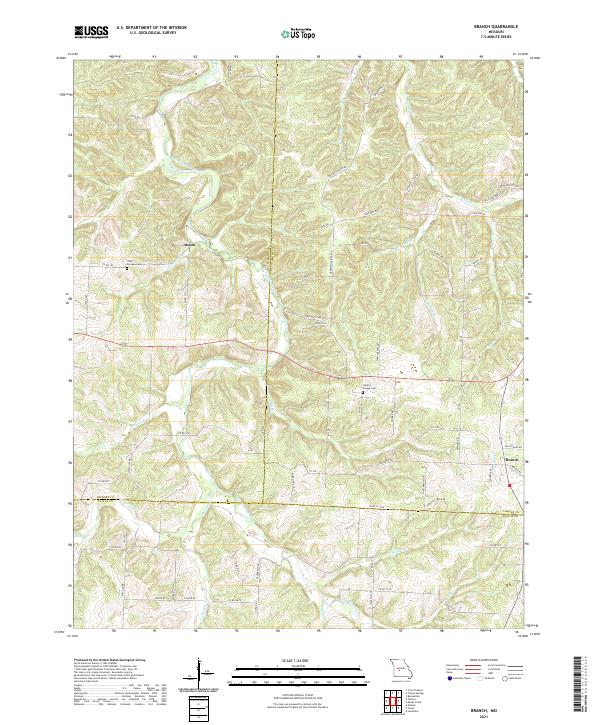
2021 Map of Branch
USGS Topo · Published 2021About this map
The Little Niangua River snakes through the center of this terrain where Hickory, Camden, and Dallas counties converge. The small settlement of Almon sits near the river's northern bend, while Branch occupies the eastern edge near the junction of Long Br and Brush Cr. This rural landscape is defined by its complex drainage network, including Macks Cr, Pippin Br, and Thomas Cr, which create a series of narrow ridges and hollows such as Coffey Hollow Rd. Local heritage is anchored by sites like Little Niangua Cem and Stanton Chapel Cem, while the road system, including State Hwy BB and State Hwy W, follows the winding topography to connect scattered homesteads and private lands.
Find a feature on this map
68 named features on this map. Tap any name to fly to it.
Don’t see what you’re looking for? This feature index may not catch every label — zoom into the map to look around manually.
Map Details
Editions of this 2021 Branch Map
This is the sole edition of this map. No revisions or reprints were ever made.
Other maps of this area

1884 · Bolivar
USGS Topo · 1:125,000

1887 · Warsaw
USGS Topo · 1:125,000

1888 · Versailles
USGS Topo · 1:125,000

1892 · Bolivar
USGS Topo · 1:125,000

1893 · Versailles
USGS Topo · 1:125,000

1894 · Warsaw
USGS Topo · 1:125,000

1934 · Macks Creek
USGS Topo · 1:48,000

1935 · Barnumton
USGS Topo · 1:24,000

1939 · Macks Creek
USGS Topo · 1:62,500

1947 · Jefferson City
USGS Topo · 1:250,000