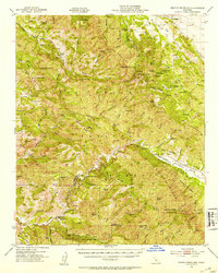
1952 Map of Branch Mtn
USGS Topo · Published 1953About this map
Buckhorn Ranch and other remote cattle stations define the high country of the Los Padres National Forest in this early 1950s survey. The landscape is dominated by the ridges of the Panza Range and the Sierra Madre Mountains, where the Cuyama River cuts a deep valley along the border of San Luis Obispo and Santa Barbara counties. This topographic study reveals a network of springs and small ranches, such as Avenales Ranch and Permasse Ranch, which supported life in this arid, mountainous interior. Landmarks like the Pine Canyon Guard Sta and Brookshire Camp Ground indicate the area's role in forest management and early recreation. The map provides a detailed view of the complex terrain between the Salinas River headwaters and the river valleys to the south.
Find a feature on this map
66 named features on this map. Tap any name to fly to it.
Don’t see what you’re looking for? This feature index may not catch every label — zoom into the map to look around manually.
Map Details
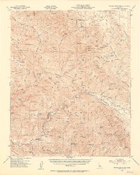
Editions of this 1952 Branch Mtn Map
3 editions found

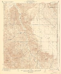
Other maps of this area

1902 · Santa Ynez
USGS Topo · 1:125,000

1905 · Santa Ynez
USGS Topo · 1:125,000

1905 · Lompoc
USGS Topo · 1:125,000

1912 · McKittrick
USGS Topo · 1:125,000

1922 · Pozo
USGS Topo · 1:62,500

1922 · Nipomo
USGS Topo · 1:62,500

1932 · La Panza
USGS Topo · 1:48,000

1935 · La Panza
USGS Topo · 1:62,500
1936 · La Panza
USGS Topo · 1:62,500

1937 · Branch Mtn
USGS Topo · 1:48,000