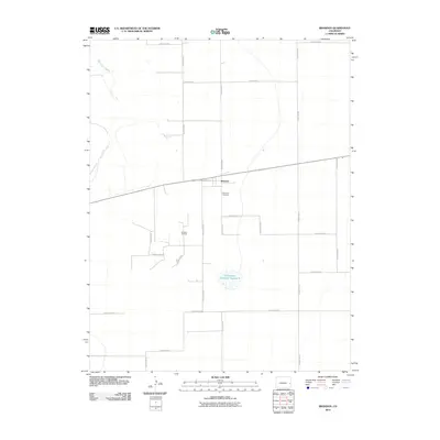
2010 Map of Brandon
USGS Topo · Published 2010About this map
Brandon sits at the intersection of a vast grid of section roads and the diagonal line of Broadway Ave in Kiowa County. This high plains landscape is defined by its agrarian and industrial utility, anchored by the Brandon Oil Field and the intermittent flow of Big Sandy Creek. The spatial layout reveals a small-scale rural hub where local genealogy is preserved at Plainview Cemetery, located just south of the primary settlement. Water management remains central to life in this semi-arid environment, as seen in the presence of Chivington Reservoir Number 4. The map documents a classic eastern Colorado prairie community where the rigid geometry of county roads like County Rd 58 and County Road N dictates the movement of people and commerce between remote homesteads and energy production sites.
Find a feature on this map
18 named features on this map. Tap any name to fly to it.
Don’t see what you’re looking for? This feature index may not catch every label — zoom into the map to look around manually.
Map Details
Editions of this 2010 Brandon Map
This is the sole edition of this map. No revisions or reprints were ever made.
Other maps of this area

1890 · Granada
USGS Topo · 1:125,000

1891 · Kit Carson
USGS Topo · 1:125,000

1892 · Lamar
USGS Topo · 1:125,000

1892 · Cheyenne Wells
USGS Topo · 1:125,000

1892 · Granada
USGS Topo · 1:125,000

1893 · Kit Carson
USGS Topo · 1:125,000

1894 · Cheyenne Wells
USGS Topo · 1:125,000

1894 · Granada
USGS Topo · 1:125,000

1954 · Lamar
USGS Topo · 1:250,000

1958 · Lamar
USGS Topo · 1:250,000