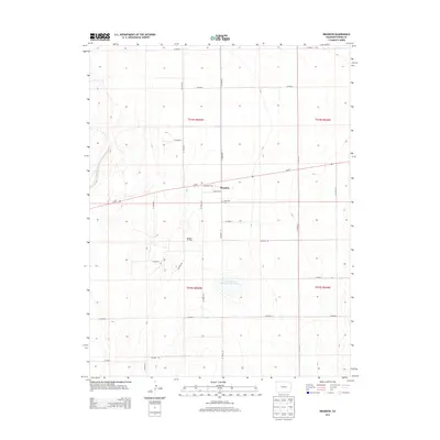
2013 Map of Brandon
USGS Topo · Published 2013About this map
Brandon occupies a central position in this eastern Colorado landscape, where the intersection of Co-96 and the local grid defined by Broadway Ave and Virginia Ave anchors the small settlement. The surrounding High Plains terrain is characterized by large-scale agricultural and industrial activity, notably the Brandon Oil Field to the southwest. Water management remains vital in this arid region, evidenced by the presence of Chivington Reservoir Number 4 and the drainage of Big Sandy Cr along the western edge of the quadrangle. For those researching local heritage, the Plainview Cem serves as a significant landmark just east of the main town site, while the extensive system of county roads, from Co Road T to Co Road J, illustrates the organized township and range system that governs the Kiowa County countryside.
Find a feature on this map
26 named features on this map. Tap any name to fly to it.
Don’t see what you’re looking for? This feature index may not catch every label — zoom into the map to look around manually.
Map Details
Editions of this 2013 Brandon Map
This is the sole edition of this map. No revisions or reprints were ever made.
Other maps of this area

1890 · Granada
USGS Topo · 1:125,000

1891 · Kit Carson
USGS Topo · 1:125,000

1892 · Lamar
USGS Topo · 1:125,000

1892 · Cheyenne Wells
USGS Topo · 1:125,000

1892 · Granada
USGS Topo · 1:125,000

1893 · Kit Carson
USGS Topo · 1:125,000

1894 · Cheyenne Wells
USGS Topo · 1:125,000

1894 · Granada
USGS Topo · 1:125,000

1954 · Lamar
USGS Topo · 1:250,000

1958 · Lamar
USGS Topo · 1:250,000