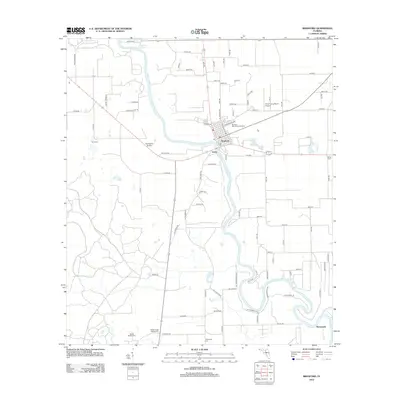
2012 Map of Branford
USGS Topo · Published 2012About this map
The Suwannee River carves a winding path through this region of North Florida, serving as the central geographic feature for the town of Branford. The landscape is defined by its numerous springs and water-related landmarks, notably Little River Springs in the northern reach and the Hal Adams Bridge crossing the main channel. The map reveals a rural settlement pattern where smaller communities like Grady and Wanamake are linked by a network of county roads.
Find a feature on this map
93 named features on this map. Tap any name to fly to it.
Don’t see what you’re looking for? This feature index may not catch every label — zoom into the map to look around manually.
Map Details
Editions of this 2012 Branford Map
This is the sole edition of this map. No revisions or reprints were ever made.
Other maps of this area

1954 · Mallory Swamp SE
USGS Topo · 1:24,000

1954 · Mallory Swamp NE
USGS Topo · 1:24,000

1954 · Gainesville
USGS Topo · 1:250,000

1954 · Valdosta
USGS Topo · 1:250,000

1955 · Mayo SE
USGS Topo · 1:24,000

1956 · Mallory Swamp SE
USGS Topo · 1:25,000

1958 · Valdosta
USGS Topo · 1:250,000

1958 · Gainesville
USGS Topo · 1:250,000

1959 · Valdosta
USGS Topo · 1:250,000

1959 · Gainesville
USGS Topo · 1:250,000