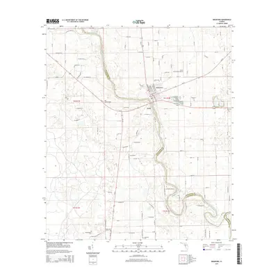
2015 Map of Branford
USGS Topo · Published 2015About this map
The Suwannee River carves a deep arc through this landscape, defining the jurisdictional boundaries between Suwannee, Lafayette, and Gilchrist counties. In the northern section, Little River Springs feeds into the river just west of the town of Branford, which serves as the primary hub of this rural corridor. The transport network is anchored by E Us 27 crossing the Hal Adams Bridge, while the smaller settlement of Grady sits just south of the main highway. Local history is etched into the landscape through numerous burial grounds, including Byrd Cem and Hatchbend Cem, as well as the Walker Creek Baptist Cem further south. The map also records aviation infrastructure like the Flints Flying Ranch Airport, reflecting a mix of agricultural river-bottom land and modern rural developments.
Find a feature on this map
106 named features on this map. Tap any name to fly to it.
Don’t see what you’re looking for? This feature index may not catch every label — zoom into the map to look around manually.
Map Details
Editions of this 2015 Branford Map
This is the sole edition of this map. No revisions or reprints were ever made.
Other maps of this area

1954 · Mallory Swamp SE
USGS Topo · 1:24,000

1954 · Mallory Swamp NE
USGS Topo · 1:24,000

1954 · Gainesville
USGS Topo · 1:250,000

1954 · Valdosta
USGS Topo · 1:250,000

1955 · Mayo SE
USGS Topo · 1:24,000

1956 · Mallory Swamp SE
USGS Topo · 1:25,000

1958 · Valdosta
USGS Topo · 1:250,000

1958 · Gainesville
USGS Topo · 1:250,000

1959 · Valdosta
USGS Topo · 1:250,000

1959 · Gainesville
USGS Topo · 1:250,000