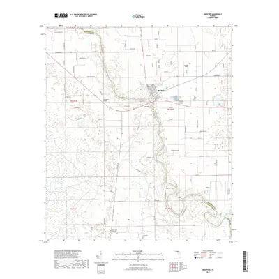
2018 Map of Branford
USGS Topo · Published 2018About this map
The Suwannee River carves a deep, winding path through the center of this landscape, serving as the primary boundary between Suwannee and Lafayette counties. The settlement of Branford sits prominently on its eastern bank, acting as a crossroads for several regional routes including S State Rte 349 and C R 450. The map reveals a dense network of country roads named for local families and flora, such as SE Cephas Liston Rd and Sidney Adams Rd, reflecting the area's agricultural and rural character.
Find a feature on this map
106 named features on this map. Tap any name to fly to it.
Don’t see what you’re looking for? This feature index may not catch every label — zoom into the map to look around manually.
Map Details
Editions of this 2018 Branford Map
This is the sole edition of this map. No revisions or reprints were ever made.
Other maps of this area

1954 · Mallory Swamp SE
USGS Topo · 1:24,000

1954 · Mallory Swamp NE
USGS Topo · 1:24,000

1954 · Gainesville
USGS Topo · 1:250,000

1954 · Valdosta
USGS Topo · 1:250,000

1955 · Mayo SE
USGS Topo · 1:24,000

1956 · Mallory Swamp SE
USGS Topo · 1:25,000

1958 · Valdosta
USGS Topo · 1:250,000

1958 · Gainesville
USGS Topo · 1:250,000

1959 · Valdosta
USGS Topo · 1:250,000

1959 · Gainesville
USGS Topo · 1:250,000