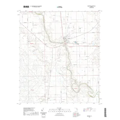
2021 Map of Branford
USGS Topo · Published 2021About this map
The Suwannee River snakes through this landscape, defining the jagged border between Suwannee Co and Lafayette Co as it flows south toward the Gulf. The town of Branford serves as a central hub, where the Hal Adams Bridge provides a vital crossing point for travelers. Further north, Little River Springs marks a distinct natural feature along the riverbanks, while the rural settlements of Grady and White Field are connected by a network of local roads such as NE Ruth Springs Rd and Old River Rd.
Find a feature on this map
108 named features on this map. Tap any name to fly to it.
Don’t see what you’re looking for? This feature index may not catch every label — zoom into the map to look around manually.
Map Details
Editions of this 2021 Branford Map
This is the sole edition of this map. No revisions or reprints were ever made.
Other maps of this area

1954 · Mallory Swamp SE
USGS Topo · 1:24,000

1954 · Mallory Swamp NE
USGS Topo · 1:24,000

1954 · Gainesville
USGS Topo · 1:250,000

1954 · Valdosta
USGS Topo · 1:250,000

1955 · Mayo SE
USGS Topo · 1:24,000

1956 · Mallory Swamp SE
USGS Topo · 1:25,000

1958 · Valdosta
USGS Topo · 1:250,000

1958 · Gainesville
USGS Topo · 1:250,000

1959 · Valdosta
USGS Topo · 1:250,000

1959 · Gainesville
USGS Topo · 1:250,000