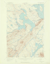
1957 Map of Brassua Lake
USGS Topo · Published 1959About this map
Rockwood sits at the eastern edge of this landscape, where the Moose River flows toward Moosehead Lake just north of Blue Ridge. The mid-century geography of this Somerset County region is defined by the massive reach of Brassua Lake and its smaller counterpart, Little Brassua Lake, which were significantly altered by the construction of the Brassua Dam. The Canadian Pacific Railroad cuts a prominent diagonal path across the territory, facilitating transit through the timberlands and connecting isolated points like Tarratine and the rail intersection at Somerset Junction.
Find a feature on this map
79 named features on this map. Tap any name to fly to it.
Don’t see what you’re looking for? This feature index may not catch every label — zoom into the map to look around manually.
Map Details
Editions of this 1957 Brassua Lake Map
5 editions found


Other maps of this area

1905 · The Forks
USGS Topo · 1:62,500

1907 · The Forks
USGS Topo · 1:62,500

1920 · Moosehead Lake
USGS Topo · 1:62,500

1921 · Brassua Lake
USGS Topo · 1:62,500

1922 · Moosehead Lake
USGS Topo · 1:62,500

1922 · Long Pond
USGS Topo · 1:62,500

1923 · Brassua Lake
USGS Topo · 1:62,500

1924 · Long Pond
USGS Topo · 1:62,500

1925 · Pierce Pond
USGS Topo · 1:48,000

1927 · Pierce Pond
USGS Topo · 1:62,500
Featured Places
- Misery Gore, ME
- Tomhegan Township, ME
- Sapling Township, ME
- Big Moose Township, ME
- Tarratine, Taunton & Raynham Academy Grant