
1924 Map of Braymer
USGS Topo · Published 1924About this map
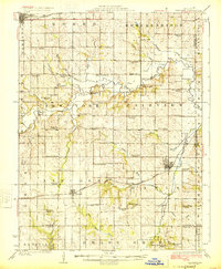
Braymer and Cowgill anchor this Missouri landscape at a time when rural education and agriculture defined the township structure across Caldwell and Ray Counties. The map reveals a dense network of country schools, including uniquely named landmarks like the Brown Jug School, Liberty Bell School, and Frog Pond School, which served the farming families of the Fairview and New York districts. These small schoolhouses are spaced nearly every few miles, highlighting the pedestrian-scale geography of the early 1920s.
Find a feature on this map
65 named features on this map. Tap any name to fly to it.
Don’t see what you’re looking for? This feature index may not catch every label — zoom into the map to look around manually.
Map Details
Editions of this 1924 Braymer Map
3 editions found
Other maps of this area

1889 · Lexington
USGS Topo · 1:125,000

1894 · Independence
USGS Topo · 1:125,000

1921 · Chillicothe
USGS Topo · 1:62,500

1922 · Gallatin
USGS Topo · 1:62,500

1923 · Chillicothe
USGS Topo · 1:62,500

1924 · Polo
USGS Topo · 1:62,500

1924 · Dawn
USGS Topo · 1:62,500

1924 · Winston
USGS Topo · 1:62,500

1950 · Kansas City
USGS Topo · 1:250,000

1950 · Plymouth
USGS Topo · 1:24,000