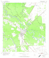
1952 Map of Brazoria
USGS Topo · Published 1974About this map
The Brazos River meanders sharply across the Texas coastal plain in this early 1950s record, creating a landscape defined by oxbow features like Horseshoe Lake and Cut-off Lake. This period of development shows the distinct separation between the town center at Brazoria and the site of Old Brazoria to the north, reflecting the shifting centers of local life. The Missouri Pacific railroad cuts a straight line through the swampy lowlands, providing a stark industrial contrast to the winding waterways of Middle Bayou and McFadden Bayou.
Find a feature on this map
24 named features on this map. Tap any name to fly to it.
Don’t see what you’re looking for? This feature index may not catch every label — zoom into the map to look around manually.
Map Details
Editions of this 1952 Brazoria Map
Other maps of this area

1943 · Jones Creek
USGS Topo · 1:31,680

1943 · Angleton
USGS Topo · 1:24,000

1943 · Snipe
USGS Topo · 1:31,680

1950 · Houston
USGS Topo · 1:250,000

1951 · Bay City
USGS Topo · 1:250,000

1952 · West Columbia
USGS Topo · 1:24,000

1952 · Sweeny
USGS Topo · 1:24,000

1952 · Cedar Lane NE
USGS Topo · 1:24,000

1952 · East Columbia
USGS Topo · 1:24,000

1952 · Brazoria
USGS Topo · 1:24,000