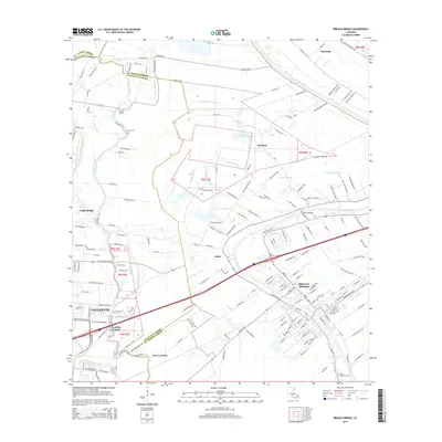
2015 Map of Breaux Bridge
USGS Topo · Published 2015About this map
Breaux Bridge serves as the focal point of this Cajun Country landscape, situated along the meandering path of the Bayou Teche. The map reveals a complex web of waterways and drainage systems typical of the Acadiana region, including the Vermilion River, Coulee Lantier, and Magenta Canal. These natural and man-made channels define the boundaries between traditional settlements like DeClouet and Anse La Butte.
Find a feature on this map
186 named features on this map. Tap any name to fly to it.
Don’t see what you’re looking for? This feature index may not catch every label — zoom into the map to look around manually.
Map Details
Editions of this 2015 Breaux Bridge Map
This is the sole edition of this map. No revisions or reprints were ever made.
Other maps of this area

1939 · St. Martinsville
USGS Topo · 1:62,500

1940 · Arnaudville
USGS Topo · 1:62,500

1946 · Lafayette
USGS Topo · 1:31,680

1952 · Lake Charles
USGS Topo · 1:250,000

1954 · Lafayette
USGS Topo · 1:31,680

1954 · Lake Charles
USGS Topo · 1:250,000

1954 · Baton Rouge
USGS Topo · 1:250,000

1955 · Lafayette
USGS Topo · 1:24,000
1955 · Lafayette
USGS Topo · 1:62,500

1956 · Baton Rouge
USGS Topo · 1:250,000