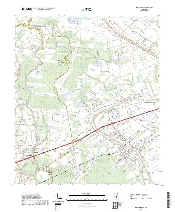
2024 Map of Breaux Bridge
USGS Topo · Published 2024About this map
Bayou Teche defines the cultural and geographic center of this portion of Acadiana, winding through the heart of Breaux Bridge where a dense network of streets and local landmarks congregate. The landscape transitions from the developed corridors of Lafayette and Carencro in the west to the intricate water systems of the east, including Coulee Datider and Coulee Cacadrie. Smaller settlements like Gecko, Bushville, and Anse La Butte anchor the rural landscape, which is still largely divided by the traditional long-lot surveying patterns visible along the major bayous.
Find a feature on this map
167 named features on this map. Tap any name to fly to it.
Don’t see what you’re looking for? This feature index may not catch every label — zoom into the map to look around manually.
Map Details
Editions of this 2024 Breaux Bridge Map
This is the sole edition of this map. No revisions or reprints were ever made.
Other maps of this area

1939 · St. Martinsville
USGS Topo · 1:62,500

1940 · Arnaudville
USGS Topo · 1:62,500

1946 · Lafayette
USGS Topo · 1:31,680

1952 · Lake Charles
USGS Topo · 1:250,000

1954 · Lafayette
USGS Topo · 1:31,680

1954 · Lake Charles
USGS Topo · 1:250,000

1954 · Baton Rouge
USGS Topo · 1:250,000

1955 · Lafayette
USGS Topo · 1:24,000
1955 · Lafayette
USGS Topo · 1:62,500

1956 · Baton Rouge
USGS Topo · 1:250,000