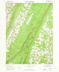
1967 Map of Breezewood
USGS Topo · Published 1973About this map
Breezewood serves as the focal point for this 1967 survey of the Fulton County ridge-and-valley landscape, where the Pennsylvania Toll Road meets the north-south corridor of 70. The topography is dominated by the massive parallel heights of Rays Hill and Town Hill, which sandwich the Brush Creek Valley. This area is characterized by scattered rural settlements like Akersville and Gapsville, often centered around community hubs such as Crystal Spring Camp and Ebenezer Ch.
Find a feature on this map
47 named features on this map. Tap any name to fly to it.
Don’t see what you’re looking for? This feature index may not catch every label — zoom into the map to look around manually.
Map Details
Editions of this 1967 Breezewood Map
3 editions found
Other maps of this area

1900 · Everett
USGS Topo · 1:62,500

1902 · Everett
USGS Topo · 1:62,500

1925 · Needmore
USGS Topo · 1:48,000

1927 · Clearville
USGS Topo · 1:48,000

1930 · Broad Top
USGS Topo · 1:62,500

1931 · Clearville
USGS Topo · 1:62,500

1933 · Broad Top
USGS Topo · 1:62,500

1935 · Needmore
USGS Topo · 1:62,500

1939 · Needmore
USGS Topo · 1:62,500

1944 · Clearville
USGS Topo · 1:62,500
Featured Places
- Gapsville, East Providence Township
- East Providence Township, PA
- Licking Creek Township, PA
- Akersville, Brush Creek Township
- Sipes Mill, Belfast Township