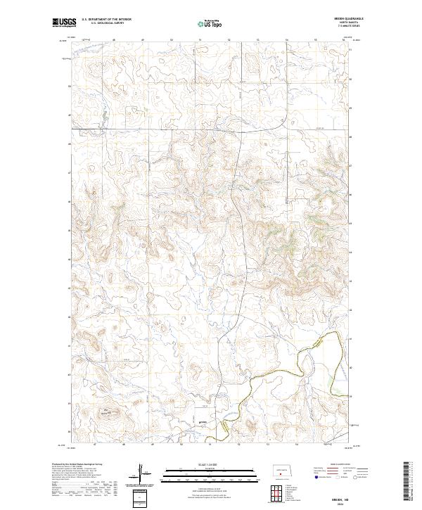
2024 Map of Breien
USGS Topo · Published 2024About this map
Breien sits along the southern bank of the Cannonball River, marking a key point of activity in this rural stretch of Morton County. The terrain is defined by its drainages, including East Fork Chanta Peta Creek to the north and Dogtooth Creek to the south, which flow through the undulating plains. A significant local landmark, War Dance Hill, rises above the river valley, offering a distinct topographical anchor for the area. The map illustrates the contemporary rural road grid, including 70th St and Co Rd 134, which connect the isolated homesteads and ranch lands that dominate the landscape. The boundary between Morton and Sioux counties follows the meandering path of the river, highlighting how natural waterways continue to define political and social geography in western North Dakota.
Find a feature on this map
15 named features on this map. Tap any name to fly to it.
Don’t see what you’re looking for? This feature index may not catch every label — zoom into the map to look around manually.
Map Details
Editions of this 2024 Breien Map
This is the sole edition of this map. No revisions or reprints were ever made.
Other maps of this area

1907 · Bismarck
USGS Topo · 1:125,000

1954 · Bismarck
USGS Topo · 1:250,000

1958 · Bismarck
USGS Topo · 1:250,000

1971 · Half Timber Butte
USGS Topo · 1:24,000

1971 · Solen SW
USGS Topo · 1:24,000

1971 · Timmer
USGS Topo · 1:24,000

1979 · Bismarck
USGS Topo · 1:100,000

1980 · Solen
USGS Topo · 1:24,000
1980 · The Hogback
USGS Topo · 1:24,000

1980 · Breien
USGS Topo · 1:24,000