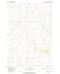
1980 Map of The Hogback
USGS Topo · Published 1980About this map
The distinct geological ridge known as The Hogback dominates the southeastern portion of this Morton County landscape, providing a sharp contrast to the surrounding drainage systems. The terrain is defined by the branching waters of the North Branch Cantapeta Creek and Northwest Branch Cantapeta Creek, which carve through the prairie alongside the SE Branch Little Heart River. These waterways illustrate the natural drainage patterns of the Missouri River plateau during the late twentieth century.
Find a feature on this map
9 named features on this map. Tap any name to fly to it.
Don’t see what you’re looking for? This feature index may not catch every label — zoom into the map to look around manually.
Map Details
Editions of this 1980 The Hogback Map
This is the sole edition of this map. No revisions or reprints were ever made.
Other maps of this area

1907 · Bismarck
USGS Topo · 1:125,000

1954 · Bismarck
USGS Topo · 1:250,000

1958 · Bismarck
USGS Topo · 1:250,000

1962 · Sugarloaf Butte
USGS Topo · 1:24,000

1962 · Schmidt
USGS Topo · 1:24,000

1968 · Cannon Ball NW
USGS Topo · 1:24,000

1971 · Huff
USGS Topo · 1:24,000
1976 · Sugarloaf Butte
USGS Topo · 1:24,000

1979 · Bismarck
USGS Topo · 1:100,000

1980 · Solen
USGS Topo · 1:24,000