
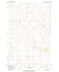
1980 Map of Solen
USGS Topo · Published 1980About this map
Cannonball River meanders through the southern portion of this Sioux County landscape, defining the northern limit of the Standing Rock territory. The small town of Solen serves as the primary settlement, situated near the river's edge with its own Athletic Field and Sewage Disposal Ponds. The local transportation history is visible in the Old Railroad Grade that traces the river valley, marking a transition from active rail to an established path. Cultural landmarks are scattered across the plateau and valleys, including St Johns Ch to the north and the Sacred Heart Cem near the town site. The northern terrain is dissected by the Northwest Branch and Cantapeta Creek, emphasizing the drainage patterns that flow toward the larger river basin below.
Find a feature on this map
19 named features on this map. Tap any name to fly to it.
Don’t see what you’re looking for? This feature index may not catch every label — zoom into the map to look around manually.
Map Details
Editions of this 1980 Solen Map
This is the sole edition of this map. No revisions or reprints were ever made.
Other maps of this area

1907 · Bismarck
USGS Topo · 1:125,000

1954 · Bismarck
USGS Topo · 1:250,000

1958 · Bismarck
USGS Topo · 1:250,000

1968 · Cannon Ball NW
USGS Topo · 1:24,000

1968 · Cannon Ball SW
USGS Topo · 1:24,000

1971 · Half Timber Butte
USGS Topo · 1:24,000

1971 · Huff
USGS Topo · 1:24,000

1971 · Solen SW
USGS Topo · 1:24,000

1979 · Bismarck
USGS Topo · 1:100,000
1980 · The Hogback
USGS Topo · 1:24,000